skip to main |
skip to sidebar
Saturday 17 September 2011 was a big day for these 'East of Eden' chronicles (and for me), as I met up with Ray Cowan after  almost 60 years at his childhood home farm in Bellahill - for my long-awaited exploration of the last unaltered stretch of the old cattle drove road from the Commons to Dalway's Bawn.
Ray now lives near Dublin with his wife Helen (uncanny again, as my own wife is called Helen too). We recently re-established contact after our early years at Eden Primary School in the 1950s, when he stumbled on this blog and an old photo taken at his 7th birthday party at his farm in Bellahill.
 The detail shows Ray and myself in the middle - Ray sporting his birthday present of a toy gun.

I had posted this old photo in July 2010 in 'An uncanny gathering at Bellahill farm, near Dalway's Bawn, in 1953' and since then we have been in frequent email and telephone contact.
But our reunion had, of course, to be back at his scene of this 'uncanny gathering' - now his brother's farm, and a walk together down the 'Cassie' (the local name given to the old cattle drove track from Beltoy to Dalway's Bawn).
Both these farm photographs show something I didn't know in 1953 - that the trees behind the farm house mark the line of the old cattle drove road from Beltoy to Dalway's Bawn.
The following map shows the line of the 'Cassie' (Ulster-Scots for 'causeway') in blue, and the present Cowan farm is marked on this map as belonging to John Davison in 1860. As followers of this blog may recall, John Davison bought Dalway's Bawn at the end of the 19th century when Marriott Dalway emigrated to Australia, and the Cowans moved to this farm about the same time - from the one immediately to the north, marked 'John Cowan, 1860'.

 The walk with Ray down the Cassie was a walk 'down memory lane' in more ways than one, and as there is too much to report in one posting, the next few will be photo-journeys and commentary on this 2-mile dander. It started where the Cassie crosses the Beltoy Road, behind the Cowan farm (to the right in this photo). Another previous post (29 September 2010) had covered the journey I made with my wife from Lough Mourne to the Beltoy Road: 'Along the Cattle Trail - In sight of Scotland'.
Well, just to prove we did finish it, here is Ray at the bottom end of the Cassie, where it comes onto the Dalway's Bawn. It was a great and memorable day - full of nostalgia and new information gleaned from Ray's encyclopaedic knowledge of every farm and field along the way.

To be continued ....
 Marriott Robert Dalway was the last of the Dalways to live at Dalway’s Bawn. He left Ireland for Australia at the end of 1886, shortly after Gladstone's first Home Rule Bill for Ireland was defeated in the Commons.
Marriott Robert Dalway had been a Liberal M.P. for Carrickfergus until he lost his seat by 37 votes in 1880 to Thomas Greer, a local Conservative. Almost immediately, Marriott Robert Dalway sought to unseat Thomas Greer on the grounds of "bribery, treating, personation, and undue influence, used either by Mr. Greer or those employed on his behalf". When the petition was finally heard and rejected in 1883 at a court in Carrickfergus, Mr. Greer was "drawn in triumph through the principal streets of the town, in an open carriage, by his enthusiastic supporters, and afterwards drawn to his residence at Seapark, where he addressed a large crowd assembled on the lawn in front of his house".
What a contrast this had been to the evening in 1868 when Marriott Dalway had been first elected as M.P. for Carrickfergus. Then "tar barrels and bonfires were lighted on all the surrounding hills". Interestingly, back then in 1868 the defeated candidate had also unsuccessfully petitioned against Dalway's election on the grounds of "corrupt practices, namely, treating, bribery, and intimidation". When Marriott Robert Dalway was again elected in 1874, he then stood as a Conservative, and "the Conservative working men manifested their delight that the Protestant cause had been successful at the election of M. R. Dalway, M.P., and that the Conservative Government had entered into office, by burning tar barrels. There was a display of fireworks from the Scotch Quarter Quay".
But the rise of Irish Catholic Nationalism in the 1880s was viewed with alarm in the mostly Protestant constituency of Carrickfergus. Marriott R. Dalway's support for the Gladstone Liberal government - in particular its proposals for Home Rule in Ireland - inevitably led to his unseating as the local population feverishly opposed the Home Rule movement (calling it "Rome Rule"). In 1886, the anti-Home-Rule Conservatives came to power in London, and the Unionist movement took off in Ireland.
 So that was the context for Marriott Dalway to take his wife Elizabeth and their three sons (Andrew, Robert and John) on board the Australasian and set sail for Melbourne to begin a new life in Australia. They arrived in Melbourne in February 1887, and set up their new home 150 km south west of Melbourne at the coastal settlement of Lorne, in Victoria.
In a previous post "Whatever happened to the Dalways of Bellahill (Dalways Bawn)?"(19 January, 2011), I gave an account of some other dimensions of Marriott Robert Dalway's career, and I had then blamed his departure for Australia on the collapse of a salt mining enterprise on his lands at Eden. But it looks as if it may have been a combination of factors that led to his departure. Of course, the demise of the Dalway cattle empire and its cattle trail across the Commons had been an inevitable casualty of steam railways and steam cattle ships operating from the bigger ports. Although Marriott Robert Dalway was at the forefront of many "diversification" schemes, his family's days at Bellahill were numbered, even as he headed the Municipal Commissioners as they distributed the lands of the "Great Commons" into small holdings.In those final years, however, there were few signs that Marriott Robert Dalway was a spent force at home. In April 1885, the future King Edward and Queen Alexandra, as the Prince and Princess of Wales, visited Carrickfergus.
"The Royal Party arrived by special train and were received at the station by Mr. Marriott R. Dalway, who wore the uniform of a Deputy-Lieutenant. On their arrival a Royal Salute of twenty-one guns was fired from the cannons at the Castle. The distinguished visitors then proceeded in carriages through Railway Street, Albert Road, West Street, Market Place, and Castle Street, to the Harbour, where Mr. M. R. Dalway, D.L., presented a most loyal address from the Municipal Commissioners and Harbour Commissioners".

A keen yachtsman, Marriott Dalway must have been attracted to Lorne at least partly by its location (In 1865, the first regatta was held at Carrickfergus, "under the direction and supervision of Marriott R. Dalway, Esq., J.P., Commodore"). The following details of his later life and that of his family in Lorne have been sent to me by Barry Wilson, who is himself connected to this Australian 'branch'. I am very grateful to Barry for also sending me photos of the Dalway graves in Lorne cemetery and allowing me to post these.
 The first Dalway burial in Lorne Cemetery off Dalway Street (where else?) was that of Marriott Dalway's wife Elizabeth who died in 1899 at the age of 65.In November of the same year (1899), Marriott married his second wife, Fanny Anna Langdon who was then 57. Fanny had been living in Lorne with her uncle Nicholas Sydenham Sabine until he died and left her a house in Lorne that was to remain the Dalway family home until Fanny died at the age of 101 in 1943.

This house was a prefabricated timber house delivered into Lorne by sea, in a ship captained by Fanny's father Capt. Frederick William Langdon.
When Fanny married Marriott Robert Dalway they both lived in it, on its original site down adjacent to the beach, near the pier. This is more than likely where Marriott Died in 1914. After Fanny's death, the house was sold and moved again to a new location where it remains as a holiday new site just outside the town and available as a holiday house called "The Gables" in the hills above Lorne.Fanny Dalway died in 1943, and is also buried in the Lorne Cemetery.

M
arriott Robert Dalway died in 1914, and he too is buried in the Lorne Cemetery, somewhat ignominiously, with his name mis-spelled. Barry Wilson, who as I say supplied me with these details, has tracked the families of the three sons of Marriott Dalway in Australia. He is a descendant of the Sabine family of Dorset, and his great, great grandfather, Rev. Thomas Sabine married a Caroline Langdon, and whose sister Jane married Capt. Frederick William Langdon - the parents of Fanny Anna DALWAY nee LANGDON, Marriott Robert Dalway's second wife.
It is a small world indeed, made all the wee-er by the wonders of the world-wide web!
 There is a cave called "O'Haughan's Cave" at the foot of the Knockagh cliffs above Greenisland, just west of the town of Carrickfergus. This was one of the hideaways of a band of outlaws led by the O'Haughan Brothers who had terrorised the lowland farms around the Commons of Carrickfergus in the early 18th century.
  They operated from caves and hideaways in the mountains until, one-by-one, they were captured by soldiers and hanged at Gallows Green near where the above photo was taken at the Troopers Lane end of Carrickfergus. Miskimmon's "History of Carrickfergus" describes three caves in the southern brow of Knockagh as,
 "cut out of the rock, which, from the difficulty of ascent to them, appear to have been intended as places of refuge ... The most western of these caves is locally known as O'Haughan's Cave. Eneas O'Haughan was one of four brothers, robbers, who were long a terror to the neighbourhood. They ascended and descended by the Deer's Lane to the house of a Mrs. Jacques".
The Knockagh escarpment is a clear boundary between the the highest and poorest land of the Commons of Carrickfergus to the north-west, and the West Division of the County of Carrickfergus with it's coastal plain sweeping down to the shores of Belfast Lough at Lower Greenisland to the south-east. Above the Knockagh, the Commons were unenclosed in the 1700s when the O'Haughan Brothers were operating. At one end of the Knockagh cliffs is a narrow gap which is the only access up onto the commons from this western section of Carrickfergus County.
 The O'Haughans were frequently chased by troops from the Garrison at Carrick up "Trooper's Lane" onto the Commons though the Stoney Glen, but then they would seem to mysteriously disappear when they backtracked in a circle down the Deer's Lane to hide in the caves underneath the Knockagh - from where they could watch for the troops returning to the town.
The map of this part of the Commons boundary shows how O'Haughan's Cave was accessed from the Commons, remembering that it was in the early 1700s when these events were unfolding, and the Commons wasn't divided into fields until after 1870.

 THE O'HAUGHAN BROTHERS
About 1710, John O'Haughan, a hill farmer was living near Braetown at the head of the Glenwhirry valley north of Ballynure, close to the Carnalbanagh Hills where the Portglenone to Larne cattle trail approached Kilwaughter and Larne. This was the home territory of the O'Haughans as far back as 1669 when we find a Donel Oge O'Haughian and a Neese O'Haughian living there in the Hearth Money Rolls of that date. By 1900 almost all of that family were living in the Ballycarry and Eden area of east Antrim, and using the spelling "Hawkins". (Interestingly enough, the 1901 census reveals a number of Catholics with the name "Haughan" living in Belfast - but in east Antrim the more numerous Hawkins were all Presbyterian).
Back about 1710, John O'Haughan was being evicted by his landlord for non-payment of rent when the bailiff was killed by one of his four sons. These four brothers - Roger, Eneas, Shane Oge and Neese O'Haughan went on the run, along with a foster brother Phelimy, and they joined an outlaw band of "freebooters" led by a "Captain" McAllister, himself from near Ballynure.
Not long after the O'Haughan brothers joined the outlaw band, Captain McAllister was captured by troops from Carrickfergus and executed. Neese O'Haughan was unanimously chosen leader in his stead, and they raided - almost always at night - farms and houses not only around the Commons and the mid-Antrim valleys of the Braid and Glenwhirry, but occasionally ventured as far as Ligoniel on the northern outskirts of Belfast, hiding out when necessary on Divis, the Black Mountain or the back of Cave Hill .
Of course, the gang only resorted to caves when being pursued, and after a successful night they frequented shibeens in clachans (farm villages) like Raloo north of the Commons where they would divide their spoils, keeping their hosts sweet with 'gifts' of rustled livestock. The exploits of the gang soon became the stuff of 'Robin Hood' - type legend, and their number included (according to one ballad): "The Boul Neese O'Haughin, and Shane Og the tory, Little Owen Murphy, and his young brother Rory. Randal John Agnew, M'Ginty, and M'Ginnis, tho' half the Braid pursue, made good the upper Teenies ". In a previous post I made mention of the Steel Boys raids from the Commons in the 1770s: "Among those convicted in 1770 was a Paddy McKenty of Raloo, who almost certainly was from the same family as the ancestors of the modern crime writer Adrian McKinty mentioned in my last posting". Adrian, who now lives in Australia, commented on that post to ask if I was saying that his great-great ... great grandfather was a cattle rustler. Hmm! No, but it is worth noting that a McKinty/McGinty was a member of the infamous O'Haughan band of outlaws in the 1710s!
When Neese O'Haughan was captured and executed, his brother Shane Oge became leader of the outlaw gang. In 1843, a folk poet from Ballynure (Samuel Turner) published a detailed account of the exploits of this gang along with a lengthy poem about "The betrayal of Shane Oge" which inevitably ends with the capture of Shane Oge. He describes elsewhere in his book how Shane Oge had, on becoming leader of the gang, "stood at the entrance of a cave at the Knockagh, and witnessed the procession that accompanied his brother to the fatal gallows at Carrickfergus".
Stories of the O'Haughans "robbing the rich to help the poor" became almost as numerous as their and legendary as their cleverness in outwitting their military and bounty-hunting pursuers. Numerous escapades are detailed in Samuel Turner's book: Gleanings from Ballyboley Braes: Career of The Freebooters Ohaughin, and Poems, (Ballymena Observer, 1843). One example of a chase of Shane Oge O'Haughan by dragoons from Carrick up to the Knockagh Cave is given in this book as follows:
On another occasion the “fogies” – as the old pensioners then doing garrison duty in the Castle of Carrickfergus were called – were ordered out to beat up his haunts about the Knockagh, and if possible to secure him. They accordingly sallied out one fine morning, and advanced cautiously and steadily till they had reached a place called Archy’s Bushes, at that time a favourite retreat for Shane Oge and his companions. Here they distinctly observed the object of their search apparently fast asleep on a ledge of rock which overhung the precipice, and looking on him now as good as taken, they dismounted from their horses, and stole forward on tip-toe to make him their prisoner. But the wily Shane Oge was not thus to be caught napping, for coolly waiting till they came within a few yards, he started up, emptied the contents of a pistol into the body of the nearest horse, slid down the precipice, and was out of sight in an instant. The fogies were thunder struck at his sudden disappearance, but thinking it impossible he could escape them, and that he must be hidden somewhere near, they commenced a strict and active search among the tangled masses of brambles, stunted bushes, and underwood with which the spot abounded, in hopes to make out his whereabouts, till convinced he was not there, they took a wider range and had at last the pleasure of lighting upon his trail. By this time, however, Shane Oge was far a-head in the direction of Glenwherry, and, owing to his having taken the precaution of choosing the worst and most impracticable paths for horsemen, it was not till they had come in sight of Ballynure that they once more caught a glimpse of the object of their pursuit. He was yet a long way off, however, and breathless and worn out by the length of the run, was straining every nerve to reach the crest of the hill at a little distance before him, when a shrill peculiarly modulated whistle struck upon his ear. The meaning of this friendly recognition he well knew, for on reaching the top of the eminence he at once threw himself flat on his face among the tall and luxuriant heather, and awaited the result with the greatest composure. It is here necessary to say that his brother Philemy, being prowling about in that direction, had witnessed the chase from the time the horsemen emerged from the Commons above Straid, and divining the cause, had awaited patiently till Shane Oge came within ear-shot and then intimating to him by the whistle to hide himself, and diverging considerably to one side so as to draw the soldiers off the direct line of pursuit, lest they might stumble on his brother in his hiding-place, he folded his arms and stood ready to shew himself to the fogies as soon as they topped the eminence, fully determined on having a new run with them over the mountains and mosses on his own account. In this he was fully gratified, for they no sooner observed him standing, as if merely drawing his breath for a moment before attempting the ascent of a somewhat steep acclivity in front, than they gave chase, little thinking they had started a fresh man, and one too that was no less swift of foot than his brother. Onward and onward they went over rock and scaur, through long heather and bog hole and quagmire – the crafty Philemy all the while never seeking to damp the ardour of the pursuit, by getting too far ahead – till he reached the old Deerpark at Glenarm, when, thinking he had done enough, he vaulted lightly over the boundary wall of the enclosure, leaving the tired and out-manouvred fogies to retrace their footsteps as they best might to Carrickfergus, crest-fallen and dispirited at the ill success of their hard day’s run.
Another story worth quoting is how Shane Oge spared a farmer in Bryantang at the Ballynure end of the Dalway Cattle Trail when he came across him at prayer:
Having heard of an old man in the neighbourhood of Ballynure named Scott, who lived almost alone and was reputed to be very rich, Shane Oge and his associates resolved on paying him a visit. Meeting therefore by appointment one evening at his residence, and reconnoitering the premises they soon found it would be no difficulty to effect an entrance; and once inside there was only a grey-haired old man and a helpless old woman to oppose their ransacking the house. Directing his companions therefore, to keep out of the way till they got the signal to advance, Shane Oge stepped up cautiously to the door, to listen if all were quiet, just as the voices of the inmates were raised aloft in prayer and praise to their Creator, before retiring to rest. He stood riveted to the spot while the good old man implored the Divine protection through the dark and silent watches of the night – heard him praying fervently for his enemies – the widow and the fatherless, the poor, the sick, the aged and the infirm, the household outcast and the wanderer, who had none on earth to help them, and knew not where to lay their head – till at length touched with compunction at what he was about to do on the unsuspecting and pious old man, he withdrew from his position at the door, as silently as he had advanced, and, beckoning on his companions, told them what he had heard, and that he had come to the determination of retiring from the place immediately and leaving him unmolested. This the others strenuously opposed, but on Shane Oge telling them flatly and plainly that the good old man was in the service of his Maker while they were in the service of the devil, and threatening them with his severest and unabated displeasure should they ever at any time from that night forth dare to molest, even to the value of a single cabbage stalk, about the premises, they at length, slowly and gloomily withdrew, muttering curses, not loud, but deep, on the sudden and unaccountable tender-heartedness of their once fierce and unscrupulous leader.
If these tales of outlaws on the Commons cattle trail don't resonate with an American connection, then I don't know what would - not even the Andrew Jackson homestead beside Dalway's Bawn.
 In this detail of a map prepared for Sir Thomas Smith's Plantation of the Ards in 1572, "Belfurst" (Belfast) is shown at the head of the "baye of Knokfergus" (Carrickfergus Bay, as Belfast Lough was once known). But just north of Knokfergus (west is at the top of this map), on the barely distinguishable peninsula of Islandmagee, is marked "Portmuk" (Portmuck).
Mark Thompson has just posted this illustration on his "Bloggin fae the Burn" blog site (as a follow-up to his recent publication Sir Thomas Smith's Forgotten English Colony of the Ards and North Down in 1572). In earlier postings of my own I talked about the cattle raids of Bryan McPhelim O'Neill on the Commons of Carrickfergus and the Smith colonists in county Down as a prelude to the arrival of John Dalway with the Earl of Essex in 1573.
Of course, John Dalway eventually married into the Clandeboy O'Neill dynasty and obtained massive estates from the O'Neills between Whitehead and Ballynure in east Antrim. This land grant was confirmed by Queen Elizabeth and James I before Dalway's Bawn was built in the early 1600s.
But this map (of 1572) shows "Bryan Ferty" between Belfast and "Glanyboy" (Clandeboy) in the back country between Ballynure and Antrim town. Trouble is, Bryan Fertagh O'Neill, who had been Lord of Clandeboy before Sir Bryan McPhelim O'Neill, was killed in 1548, nearly a generation earlier than the Smith plantation.
Bryan Fachartach (also Ferty, or Fertagh) O'Neill, was great, great grandson of Aodh Buidhe (Hugh Boy) O'Neill, the progenitor of the whole Clandeboy (Clann Aodh Buidhe) O'Neill dynasty in east Ulster in the late 14th century.
However, this is ground I have covered before, so what is new? Well, we know that before John Dalway "established" the cattle trail from the lands behind Carrick to Scotland via Portmuck and Whitehead, it was the O'Neill's who were in control of the cattle-based economy in the hinterland of the medieval English colony of Carrickfergus. The trade from Carrick was with England although in the 1590s Elizabethan tower-houses or castles were also built at Whitehead and Portmuck to defend these "new" trading ports. But this map suggests that Portmuck was operating as a port (and a strategic one at that) at a time when the O'Neills controlled Islandmagee and east Antrim. Was there a cattle trade with Scotland in Bryan O'Neill's day? I think it is possible, and it could mean that our cattle trail is of even greater antiquity than from the days of Dalway's Bawn.
 Postscript: I had just finished this post when Mark Thompson e-mailed me the short message: "Here's another"! This map is what was attached - it must be about the same date as the 1572 one as it has "Smites" castle marked on the Ards peninsula. But here again is "Karregfergus" and "Port Muk" (and perhaps Muck Isle marked as "The Kowe").
Another postscript: I mentioned before that Adrian McKinty's three fantasy novels (The Lighthouse Trilogy) set on Muck Isle at Portmuck involved a fictional American boy, Jamie O'Neill, who inherited the island and a "Laird of Muck" title from the ancient Ui Neill owners of the area. Well for those with local knowledge that think such a connection with the O'Neills is impossible - well, think again!
 In 1860, two James Eslers (father and son) were living beside each other a few fields away from Dalways Bawn. James Esler, senior, was in the home-townland of the Dalways at Bellahill as a byresman. He held his small thatched cottage from one of Marriott Dalway's main tenants - Alexander Hart. James Esler, junior, was similarly stationed nearby, but as he was in the townland of Dobbsland, and a Dobbs' tenant, he may have been a cattle hand at Castle Dobbs.
These Eslers were part of an extended family group (all spelled Essler in the 1860 Land Valuation) that were involved as cattle drovers, dealers and steaders at the Whitehead and Islandmagee end of the Commons cattle trail between Ballynure and Scotland. My earlier post "The Big Picture: Eslers and the 'Scotch' Cattle Drove Roads of mid Antrim", August, 2010, has the details of these Eslers and the more numerous group in mid Antrim that handled the Portglenone to Scotland cattle trail via Ahoghill and the port of Larne.
But where did these Eslers come from? They were all lowland Scots, arriving in east Antrim in the 17th century as horse and cattle drovers, and small hill farmers 'servicing' the cattle trails, according to family tradition. (My own great-grandfather was another James Esler from a hill-farm in Ballybeg, near Ahoghill).
In 1666 we get our first glimpse of the Antrim Eslers in the Hearth Money Rolls, prepared as a tax on all householders with a fixed chimney in their house. They then spelled their name Assler, Asslar or Ashler, but appear to be absent from the small Parish of Kilroot, which includes the townlands of Dobbsland and Bellahill. In practice, the names on this list don't include the landless, labouring classes, only farmers and landowners, and so although we do have a Mr Richard Dobb, a Mrs Dalway, a Mr Alex Dallway and a David Hart (an ancestor of Alexander Hart in 1860, and a descendant of the Capt. Hart who first settled here with John Dalway in the reign of Elizabeth I) the absence of an Assler/Esler from the 1666 Hearth money roles is not significant. But in the adjacent Parish of Templecorran, we find a James Asslar in 1666. This Parish covers the land between Ballycarry, Dalway's Bawn and Whitehead (where the 100 acre farm of William and David Essler controlled the land behind the port of Whitehead in 1860). There were no other Asslers in east Antrim in 1666, not even in Islandmagee where the farms of Patrick and Andrew Essler were in 1860.
Apart from this 'Whitehead' James Asslar, there are only 4 other Eslers recorded in the Hearth Money rolls for 1666 for Antrim. Three of these were living near the port of Larne: In the Parish of Kilwaughter we have John Ashler in Ballyhampton townland on the Agnew estate close to the port, and William Ashler on the nearby Agnew demesne. These names were both spelled 'Asler' on a repeat listing of 1669. A Thomas Ashler was living somewhere south of Larne, in either Inver or Glynn Parish in 1666. Family tradition has it that three Esler brothers came from Scotland in the 1600s and settled in three different parts of mid and east Antrim, giving rise to all the Antrim Eslers. If this is correct, then the main original settlement seems to have been at Kilwaughter near Larne, on the estate of the Agnews of Kilwaughter Castle and Lochnaw Castle near Stranraer in Scotland. The only other Esler in the 1666 Hearth Money Rolls is John Ashler at Rathkeen in the Parish of Rathcavan. This is on the upland between where the Braid and Glenwhirry river valleys run down to Ballymena, and where 'Eslertown' and the main concentration of Eslers survive along the Portglenone to Larne cattle trail.
So, if the '3 brothers' story is true, it seems that the first and main settlement of Eslers was at Larne, and the secondary settlements were at Rathkeen near Broughshane in mid-Antrim, and Whitehead/Ballycarry in east Antrim.

This gives us a real clue to the Scottish roots of our Eslers, for the Agnews of Kilwaughter Castle were from immediately across the North Channel at Lochnaw - between Portpatrick and Stranraer. And Portpatrick was the port of entry for the enormous cattle trade from Donaghadee in county Down, and the beginning of the major Galloway Cattle Drove road to Carlisle. In A.R.B. Haldane's book, "The Drove Roads of Scotland", he states that between 1786 and 1790, over 55,000 head of Irish cattle were imported into Portpatrick, and in 1812 as many as 20,000 were landed. His map of the drove roads of Scotland shows the sea link for this trade between Donaghadee in county Down and Portpatrick.
Here then is a short abstract about the Agnews of Lochnaw and Larne (Kilwaughter):

Lochnaw Castle
In 1375 "The Agnew", Lord of Larne, went to Ireland with Edward Bruce, younger brother of King Robert the Bruce where he had been invited by the Irish Lords to help rid them of the English and rule in their place. Agnew stayed with Edward in Ulster for three years while he attempted to establish his power.
Andrew Agnew of Lochnaw was granted the lands and constableship of Lochnaw Castle in 1426. In 1451 he was appointed Sheriff of Wigtown, an honour still held by direct descendants today.
During the 15th century the Clan Agnew rose to power however this was under the powerful Clan Douglas. When the Douglases fell from the Kings favour the Agnews in Galloway in fact benefited. However this then brought them into many conflicts with the Clan MacKie and the Clan MacLellan.
16th century
In the 16th century during the Anglo-Scottish Wars Andrew Agnew of Lochnaw, was killed at the Battle of Pinkie in 1547 in fighting against the English.
Sir Patrick was MP for Wigtownshire from 1628 to 1633, and again from 1643 to 1647. He was created a Baronet of Nova Scotia on 28 July 1629. He died in 1661 and was succeeded by his eldest son, Andrew, who had been knighted in his father’s lifetime and who was also returned as MP for Wigtownshire. He was created Sheriff of Kirkcudbright as well as Wigtown in the 1650s, when Scotland was part of the Protectorate with England. He married Anne Stewart, daughter of the first Earl of Galloway.
The fifth Baronet, another Andrew, married a kinswoman, Eleanor Agnew of Lochryan, the union producing no fewer than twenty one children.
So the Agnews were known as "Lords of Larne" from the 14th century when they first visited east Antrim with Edward the Bruce! Their Kilwaughter estate was granted in the 17th century as part of the Ulster Plantation of lowland Scots, and by 1659 Kilwaughter Parish had the highest proportion of "Scotch" inhabitants of any Parish in Ireland (over 90%). It may well be that the first Eslers came with the Agnews from their Lochnaw estate near Portpatrick - or maybe they were continually moving west, "sourcing" cattle back along the drove routes from Dumfries and pioneering the western extension of this deep into county Antrim. This is well worth somebody chasing up on the ground in Scotland! But certainly our Eslers at Dalway's Bawn were part of something bigger as far as the cattle trade with Scotland is concerned. One thing is sure - the Esler story is the classic Ulster-Scot story.
 The ghostly footprints of ancient sod walls still mark the sites where families once moved with their cattle up to uplands in county Antrim during the summer months (from May to October). They built temporary "booley" huts to live in, usually beside a water burn or spring.
"Booleying" - what the text-books call transhumance in other parts of the world - comes from the Irish "booley" or "boley" that is used to describe either the upland summer grazing place for cattle or the summer hill dwelling used by the herdsmen. These huts were made of sod and timber branches covered with rushes for thatch. Some 400-year-old drawings of these huts give an idea of how they were put together.


In the 1570 picture-map of Carrickfergus, it almost looks as if they had descended on the town after the summer for a harvest Feast of Tabernacles!
The old custom was for the young folk (sometimes the entire family), to leave the "clachan" (a cluster of farms with solid buildings) in the lowlands as soon as the crops were sown and migrate to summer pastures in the hills. When the lands between Carrickfergus town and the Commons were parceled out in the 1500s into Aldermans Shares (strips of single, dispersed farms within their own fields), the Commons was still intended for summer grazing by these farmers. But it was the farms on the far (northern) side of the Commons that were still "booleying" on the Commons when the practice had died out in the 1800s elsewhere.
When the Commons itself was finally divided up into farms and fields there was serious unrest, with bands of men pulling down the new fences in 1880 and attacking anybody who tried to build permanent houses. There had always been a slight sense of lawlessness connected with cattle on the Commons. In the early days, Bryan O'Neill was cattle raiding on a grand scale here in the 1500s, and cattle stealing remained a problem down to the Steelboys revolts in the 1770 when men from this early secret society of anti-establishment Presbyterian peasants burned down farmhouses and stole cattle belonging to the wealthy farmers (including some of Mr. Dalway's tenants) near Carrickfergus. Ransoms were demanded and the money was to be left at the Priest's Rock (Craignabraher) on the Commons, which is where the Covenanters held their open air meetings. It was soon discovered that the culprits were from the clachan of Raloo just to the north. Among those convicted in 1770 was a Paddy McKenty of Raloo, who almost certainly was from the same family as the ancestors of the modern crime writer Adrian McKinty mentioned in my last posting.

The families that took their cattle to booley places on the Commons like Ardboley (High Booley), Carnbilly (Booley Cairn) or Milky Knowes had their home farms down on lower ground in clusters or villages called "clachans". The arable land around each clachan was shared out between the group in a jigsaw of tiny plots and strips each year, and when the cattle returned before the 1st November, the field markers were torn down and the land around the clachans returned to common winter grazing. The homecoming to the clachan at harvest time (at the latest 1st November) was another great time of celebration and seasonal customs, closely tied up with Halloween bonfires and gatherings on 31st October.

 When I was a young student, 40 years ago, I made a study of some of these clachans that had survived in the 1830 landscape north of the Commons in south-east Antrim - Glenoe, Raloo, Mackeystown, Ballylagan, Drummondstown, Lylestown, Uppertown and Browndod. In Scotland, such clachans are also called "farm-towns" (or if they have a church or mill: "kirk-towns" or "mill-towns"). Glenoe was properly a mill-town as it was clustered around a water-powered corn mill near Glenoe waterfall, and Raloo - still a really impressive clachan if you can find it - is a kirk-town with a (Non-Subscribing) Presbyterian Meeting House hidden among the cluster of surviving farms down a country lane.
 When the family groups moved from these clachans in May along with their cattle to the summer booley pastures, their tracks up onto the high ground of the Commons cut across the established Dalway cattle trail, as shown on the map. This must have involved strange encounters, if not a clash of cattle herding cultures. And the booleying one was always the "poor cousin": often stigmatised with the idea that their encroachment was trespass. Another perception was that these "booley boys" were involved in cattle stealing, or worse. Not only did the Steelboys from Raloo conspire at the Priest's Rock near Ardboley on the Commons in 1770, but this was also the Commons rallying point for the local United Irishmen in 1798 before joining the Ballycarry Corps on their way to the Battle of Antrim. Of course, as the Commons had no permanent buildings or occupants in the 18th century, these "rebels" were from the radical Presbyterians that had lived in and around these clachans. These were the men who saw the establishment - be it landlords, government or established (Episcopal) church - as the same enemy as had been successfully overthrown in America by their first and second generation Scotch-Irish cousins in the American War of Independence. But the price of failure in Antrim was a dissenting tradition that has been submerged and forgotten for hundreds of years. The landscape north of the Commons is one of a rich, hidden heritage that has to be searched carefully for, off the beaten pad, and certainly off the tourist trail.
So, if you pass through Glenoe (the only clachan which has a surfaced, drivable road through it), try and see beyond the picturesque waterfall to that hidden history of clachans, booleying and a "dissenting" independent spirit that typifies the local folk
 . I visited Glenoe waterfall again last month and as Helen and I walked up through the village it reminded me of a similar walk we had near Boone, North Carolina some 30 years ago - and then walking through Glenoe 20 years ago with friends from Kentucky. When you add the shared history and heritage together, the "mountain men" of this part of Antrim and the "hill-billys" of the Apalachians have more than genes in common.
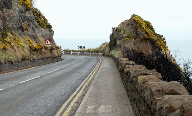
 Whitehead is a quiet sea-side town, just a short hop on the train from Carrickfergus towards Larne. The road 'East of Eden' to Larne goes past the back of the town too, but it is a bit of a push on the bike as the road climbs over the high headland of "Whitehead" at a place called the "Blaa Hole", then down a very steep side road into the town.
 The Blaa Hole (blow-hole) was, as the name suggests, a bit of a wind tunnel. I remember my dad wakening me up to show me his first car that he had brought home the night before. He took me a run to Whitehead and back before school, and, coming through the Blaa Hole, the bonnet flew up and covered the view out the windscreen. So I had good reason to remember the reason behind the name - for the sea was a terrifying 200 feet below when we finally stopped against the stone wall!
 The view looking down on the town from the Blaa Hole shows the promenade, an open-air swimming pool and the small quay at the far end of the bay. This residential town I remember being full of "oldies" (retired senior citizens), and as a place where our parents took us for walks along the shore to Blackhead lighthouse on the far headland.
But as boys we sometimes walked to Whitehead along the railway track, past Jonathan Swift's  "Round House" at Kilroot, and along the coast to the White Harbour, underneath the Blaa Hole. This was a hidden world with a limestone quarry on the landward side of the railway track, and the derelict White Harbour (it was silted up then)on the other. It was built of massive cut white limestone blocks, and was once used to export the limestone. It was such a marvel to us that our walks to Whitehead often never got past this point.The railway tracks separated here, with a single track hugging the coast, and the Whitehead-bound track cutting through the headland into a short tunnel which still emerges immediately into the town. The two tracks converge before reaching the period railway station in Whitehead, surviving much as it was when it was built in 1877.
 Whitehead is the gateway to the peninsula of Islandmagee. It is a Victorian sea-side "railway town", and when the station was opened, it became a tourist haven for day-trippers from Belfast, especially those wanting to visit the Gobbins Cliff Path in Islandmagee by connecting jaunting car, or the nearby Blackhead lighthouse with its similar but less daunting cliff walks.
 This earlier view of Whitehead from the Blaa Hole about 1900 is deceptive. It gives the impression of a long-established settlement, but in fact the oldest buildings visible are the Customs Houses in the middle foreground with the square Watch-tower at the far end. This Customs Station was built just before the railway about 1850. The map of the townland of Whitehead in 1860 tells a very different story as far as the age of the town is concerned.
 Here, in 1860, we see the railway line completed but no station built as yet, and there is no town whatsoever. The entire area of the present town, from the coast to the main Larne road, was a 100-acre farm in the hands of William and David Esler (spelled Essler in the 1860 land valuation). This included the Coastguard Buildings which were leased from this farm and the significance of these Eslers to the running of the Antrim cattle drove trails to Scotland has already been described in an earlier post ("The Big Picture: Eslers and the 'Scotch' Cattle Drove Roads of mid Antrim", August 2010). The fact that they were landlords for the Whitehead Customs buildings at this port at the end of the Dalway's Bawn Cattle Trail is quite staggering! But, as we shall see, the Esler control was even more decisive in Islandmagee proper.
 The two tiny ports of Whitehead and Portmuck that link the end of the east Antrim Cattle Trail with the main Scottish Drove Roads were effectively "twinned" from the 16th century down to the 1850s. Each had an Elizabethan "castle" maintained and garrisoned from Carrickfergus - not for defence, but to control the customs duties due from trade with Scotland. These subsidiary "creeks" as they were called in the 17th century were a constant headache for the main port of Carrickfergus, and so the Customs stations at Portmuck and Whitehead were their direct descendants.
Castle Chichester in Whitehead is the only pre-Victorian building in the town (its shared history with Portmuck Castle is also described in previous posts).
Whitehead was one of two tiny ports marking the end of the east Antrim Cattle trail. The trail splits behind Muldersleigh Hill north of Whitehead, the hill whose coastal headland is the location of Blackhead lighthouse. I have added to a contextual map of Islandmagee and Whitehead not only the route of the end of the Cattle Trail, but also the location of the Islandmagee farms of Patrick and Andrew Esler in 1860 siuated side by side between the Gobbins Road to Portmuck and a small break in the Gobbins cliffs called "Heddle's Port".
The Eslers' farms in Islandmagee were mostly in the townland of Balloo, about midway along the Gobbins coast, and a few hours cattle drove from Portmuck. Unlike the Eslers at Whitehead, they had no interest in the port itself, and maybe had good reason to be just out of immediate sight of the Customs Station there. Smuggling was of course, illegal, but when it involved simply the occasional avoidance of duty payments for horses being landed or cattle being shipped out to Scotland, it was not as rigorously pursued as the illicit trade in spirits and tobacco. A row of thatched cottages at the end of Sally Kane's Loanen on Patrick Esler's farm in Balloo was called "Caleery-town". According to the local historian Dixon Donaldson writing in the 1920s, this name was given because it was a popular rendezvous for the "young bloods" of the neighbourhood. Dixon Donaldson also wrote that there were smugglers caves along the Gobbins. One near Portmuck "... is called the Horse Cave where it is said stolen horses were hidden until transferred to smuggling vessels for transportation." Another cave, long forgotten, was discovered by two boys on the farm of Mr. Esler's "... on the face of the heughs above Heddle's Port. A rope and candles were procured ..." and the boys discovered the remains of barrels and other contraband. (Every time I read this, I think of Tom Sawyer and Huckleberry Finn!)
If, as seems likely, the "Esslers" of Islandmagee, Whitehead and Dalway's Bawn were all related, it is the Islandmagee farm which seems to be the earliest settlement. A local graveyard near Balloo has all the known Esler graves, some going back to the early 1800s and apparently including an "Uncle David" Esler of Whitehead.
These 'East of Eden' Chronicles have stumbled on many connections with famous writers such as Jonathan Swift and Mark Twain. And there are others still to be met with. But just now, for reasons which will soon become obvious, I must bring the modern crime writer Adrian McKinty into the story. He was born and raised in Carrickfergus, only a stone's throw away from Boneybefore, although he has lived for most of his writing career in America and Australia. Adrian McKinty is best known as a writer of crime and mystery novels such as the award-winning "Fifty Grand", or the one I first discovered, "Hidden River".
I was outside a shop in the south of England, impatiently waiting for my wife and browsing through some books for sale. American crime novels are not usually my scene, but the author's name (McKinty) caught my attention: a Les McKinty lived nearby to Boneybefore when I was a boy, and he cycled to work every day to Castle Dobbs where he worked on the Dobbs' estate. His sons were in the Star of Eden Pipe Band, so imagine my surprise when I flicked open the first page and found that the American detective in the story was originally from Carrickfergus! Eagerly reading whatever else of McKinty's books I could get hold of, I found that I actually liked these crime novels anyway. But the bonus was that several of his books have really strong local associations: "Orange Rhymes with Everything" is set in Carrickfergus, and "The Lighthouse Land" in Islandmagee.
 In fact, the main setting of "The Lighthouse Land" is Portmuck, or to be precise Muck Isle. The book is the first of three in the Lighthouse Trilogy of "young adult sci-fantasy novels" - different from the decidedly adult crime novels. A young American boy, Jamie O'Neill, inherits the small isle of Muck through a previously unknown descent from the Elizabethan Clandeboy O'Neills - and travels to take up his new life across the causeway on the island:
"But the island has a secret, locked in the top of its ancient lighthouse ... Discovering the secret will send him on an interstellar mission that could change the course of his life, and the universe, forever."
The story is well worth reading, even as an adult, but I can't resist being parochial in my enthusiasm. The area around Portmuck is described vividly as Jamie makes local friends and travels daily to school in Carrickfergus. So too is Muck Isle, apart from the obvious fact that the real Muck Isle doesn't have a lighthouse.
 That is where Blackhead Lighthouse at Whitehead comes in. Adrian McKinty has cleverly brought the two together in a way that almost makes me expext to see Blackhead lighthouse on Muck Isle when I go down the steep road to Portmuck. He still has family connections in Whitehead and Carrickfergus, but the McKinty roots are firmly grounded in the Islandmagee - Magheramorne area. I almost expect to find some of them along with the Eslers as I explore and re-trace the historical path of the old Dalway cattle trail from Ballynure to Portmuck and Whitehead.
 almost 60 years at his childhood home farm in Bellahill - for my long-awaited exploration of the last unaltered stretch of the old cattle drove road from the Commons to Dalway's Bawn.
 The detail shows Ray and myself in the middle - Ray sporting his birthday present of a toy gun.


